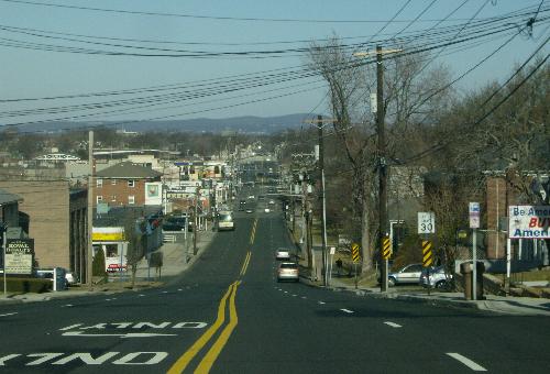
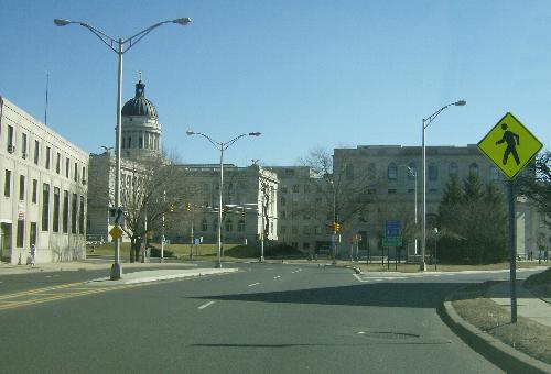
The road’s path from Paterson to Hackensack is quite simple, Market Street and Essex Street. This portion of the road was part of the pre-1928 NJ 10. (An abutment marked “State Highway Route 10” still exists on the Saddle River bridge.) NJ 10 then followed modern CR 124, US 1/9, and NJ 5 to Edgewater.
Once you get to the courthouse in Hackensack, however, things get a bit confusing. The road crosses the Court Street bridge, but the stretch between Main Street and the bridge is one-way eastbound, and the equivalent westbound stretch does not appear to be controlled by the county. And the first segment of CR 56 abruptly ends at River Road (CR 41) in Bogota, as Fort Lee Road does not cross the West Shore Railroad. (It did, once upon a time.) Traffic must head north on River Road for a block and then turn right on Bogota’s Main Street – which is part of the second primary segment of CR 56, which started at River Street in Hackensack.
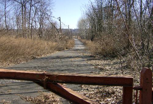
This second stretch of CR 56 does make it all the way to Hudson Terrace in Fort Lee, using the DeGraw Avenue extension over the Bergen-Passaic Expressway in Teaneck to connect to Fort Lee Road in Leonia. However, a very short stretch of Fort Lee Road in Teaneck (just to the east of Teaneck Road) is county-controlled, until that long-abandoned old road, which certainly did connect to Fort Lee Road in Leonia many years ago, drifts off into the Overpeck swamp.
Yet another short stretch of road listed as CR 56 carries westbound traffic off the Midtown Bridge over to River Street, as the road called Midtown Bridge Approach is one-way.
| Mile |
Street Name |
Feature (West to East) |
| 0.00 |
CR 56 BEGINS, Elmwood Park Boro |
| 0.00 |
Market St |
Passaic River {bridge} |

Westbound crossing the Passaic River on a 1923 bridge that once carried NJSHR 10. |
| 0.05 |
Market St |
River Rd, CR S-69 |
| 0.35 |
Market St |
River Dr, CR 507 {signal} |
| 0.43 |
Market St |
Bergen-Passaic Expwy, I-80 {underpass} |
| 0.50 |
Market St |
Van Riper Ave, CR 105 |

Westbound on Market Street approaching Van Riper Avenue (right) and I-80. |
| 0.69 |
Market St |
Church St {signal} |
| 0.96 |
Market St |
Boulevard {signal} |
| 1.01 |
Market St |
Unnamed stream {bridge} |
| 1.04 |
Market St |
Garden State Pkwy, NJ 444 {underpass} |
| 1.19 |
Market St |
Susquehanna Railroad spur |
| 1.59 |
Market St |
Midland Ave, CR 67 {signal} |
| 1.63 |
Entering Saddle Brook Boro |
| 1.63 |
Market St |
Erie Railroad {at-grade crossing} |
| 1.65 |
Market St |
(Erie St) {signal} |
| 1.81 |
Market St |
[5 St] {signal} |
| 2.23 |
Market St |
(Mayhill St) {signal} |
| 2.42 |
Market St |
Westminster Pl, [CR 65] {signal} |
| 2.83 |
Market St |
Saddle River Rd, CR 79 |
| 2.91 |
Market St |
Bergen-Passaic Expwy, I-80 {underpass} |
| 2.92 |
Market St |
Saddle River {bridge} |
| 2.92 |
Entering (Rochelle Park Boro) [Lodi Boro] |
| 2.94 |
Essex St |
(Rochelle Ave) [Main St], CR 61 |
| 3.15 |
Essex St |
[Riverview Ave, to I-80 interchange 63] {signal} |
| 3.40 |
Entering (Maywood Boro) [Lodi Boro] |
| 3.48 |
Essex St |
NJ 17 {overpass} |
| 3.61 |
Essex St |
(Maywood Ave, CR 13/59) {signal} |
| 3.82 |
Essex St |
Susquehanna Railroad spur {at-grade crossing} |
| 3.83 |
Essex St |
[Shopping center entrance] {signal} |
| 3.87 |
Entering Hackensack City |

From Summit Avenue, looking westbound. |
| 4.20 |
Essex St |
Summit Ave, CR 57 {signal} |
| 4.29 |
Essex St |
Prospect Ave {signal} |
| 4.55 |
Essex St |
(1 St) [Polifly Rd], CR 55 {signal} |
| 4.66 |
Essex St |
Newman St {signal} |
| 4.74 |
Essex St |
Erie Railroad {at-grade crossing} |
| 4.98 |
Essex St |
(State St) [Huyler St) {signal} |

Eastbound on Essex Street approaching the Bergen County courthouse.
Hudson Street, CR 124, bears to the right. |
| 5.10 |
Essex St |
Hudson St, CR 124 {signal} |
| 5.10 |
CR 56 bears left onto Main St |
| 5.19 |
CR 56 bears right onto Court St |
| 5.19 |
Court St |
Main St {signal} |
| 5.34 |
Court St |
River St, CR 503 {signal} |
| 5.43 |
Court St |
Hackensack River {bridge} |
| 5.43 |
Entering Bogota Boro |
| 5.76 |
Fort Lee Rd |
Railroad crossing control {signal} |
| 5.79 |
Fort Lee Rd |
Susquehanna Railroad {at-grade crossing} |
| 5.83 |
Fort Lee Rd |
River Rd, CR 41 {signal} |
| 5.83 |
CR 56 ENDS, Bogota Boro
Through traffic turns left at CR 41 and then right at Main St, CR 56 |
| 0.00 |
CR 56 BEGINS, Hackensack City |
| 0.00 |
Midtown Bridge Approach |
River St, CR 503 |
| 0.20 |
Midtown Bridge Approach |
Salem St, CR 56 westbound |
| 0.31 |
Midtown Bridge |
Hackensack River {bridge} |
| 0.31 |
Entering Bogota Boro |
| 0.61 |
Main St |
River Rd, CR 41 {signal} |
| 0.74 |
Main St |
Larch Ave {signal} |
| 0.81 |
Main St |
Elm St {signal} |
| 0.86 |
Main St |
West Shore Railroad {overpass} |
| 1.05 |
Main St |
Palisade Ave {signal} |
| 1.15 |
Entering Teaneck Twp |
| 1.31 |
DeGraw Ave |
Queen Anne Rd {signal} |
| 1.77 |
DeGraw Ave |
Teaneck Rd, CR 39 {signal} |
| 2.03 |
DeGraw Ave |
Branch Overpeck Creek {bridge} |
| 2.09 |
DeGraw Ave |
Frank W Burr Blvd {signal} |
| 2.37 |
DeGraw Ave |
Bergen-Passaic Expwy, I-95 interchange 70 {overpass} |
| 2.55 |
DeGraw Ave |
Overpeck Creek {bridge} |
| 2.55 |
Entering Leonia Boro |
| 2.89 |
Fort Lee Rd |
Northern Railroad {at-grade crossing} |
| 2.92 |
Fort Lee Rd |
[Meadowview Station Pkwy] {signal} |
| 2.93 |
Fort Lee Rd |
(Willow Tree Rd {signal} |
| 3.03 |
Fort Lee Rd |
Grand Ave, NJ 93/CR 501 {signal} |
| 3.32 |
Fort Lee Rd |
Broad Ave {signal} |
| 3.47 |
Fort Lee Rd |
Glenwood Ave {signal} |
| 3.75 |
Entering Fort Lee Boro |
| 3.81 |
Main St |
Bergen Blvd, US 1/9/46 {underpass} |
| 3.84 |
Main St |
Maple St {signal} |
| 4.05 |
Main St |
(Edwin Ave) [John St] {signal} |
| 4.21 |
Main St |
(Linwood Ave, CR 29) {signal} |
| 4.21 |
Next 0.04 mile co-signed with CR 29 |
| 4.25 |
Main St |
Anderson Ave, CR 29 {signal} |
| 4.40 |
Main St |
Center Ave, CR S-29 {signal} |
| 4.53 |
Main St |
Lemoine Ave, NJ 67 southbound {signal} |
| 4.55 |
Main St |
Schlosser St, NJ 67 northbound {signal} |
| 4.63 |
Main St |
(Martha Washington Dr) [Palisade Ave] {signal} |
| 4.79 |
Main St |
Bigler St, CR S-56 |
| 4.85 |
Main St |
(Hudson Terr) [Main St], CR 505 |
| 4.85 |
CR 56 ENDS, Fort Lee Boro |
The road is inventoried east to west, in order to match the flow of traffic.
The road is inventoried north to south, in order to match the flow of traffic.


