
The first starts from Teaneck Road (CR 39) in Ridgefield Park and heads up the east side of the Hackensack River until it reaches New Milford -- where it stops cold. The second picks up in Closter, about four miles from the end of the first section, and runs across to Closter Dock Road (CR 502). I don't know what roads CR 41 was supposed to take to connect these two disparate sections.
The NJDOT straight-line diagrams inventory the northeast section of CR 41 from east to west, but I have inverted it both for consistency and to follow the direction the road would have needed to follow if it were connected.
Most of the first section of the road is signed as part of primary route 17.
| Mile | Street Name | Feature (South to North) |
| 0.00 | CR 41 BEGINS, Ridgefield Park Village | |
| 0.00 | Mount Vernon St | Teaneck Rd, CR 39 {signal} |
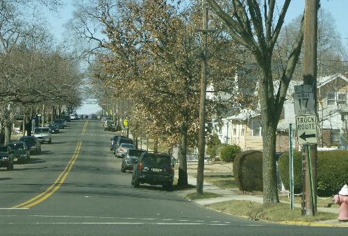
 Mount Vernon Street, looking westward from Teaneck Road. |
||
| 0.35 | Mount Vernon St | Main St {signal} |
| 0.42 | CR 41 bears right onto Railroad Ave | |
| 1.23 | Railroad Ave | Bergen-Passaic Expwy, I-80 {underpass} |
| 1.27 | Entering Bogota Boro | |
| 1.27 | Railroad Ave becomes West Shore Ave | |
| 1.37 | CR 41 bears left onto River Rd | |
| 1.40 | River Rd | West Shore Railroad {underpass} |
| 1.95 | River Rd | Fort Lee Rd, (CR 56) {signal} |
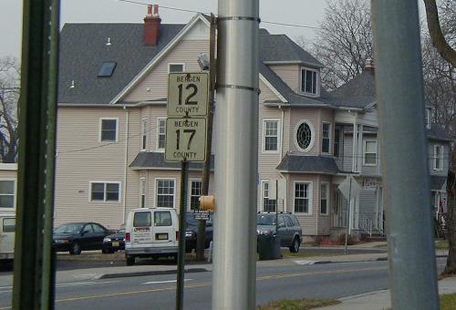
 River Road northbound, at Fort Lee Road. Note the sign for county primary routes 12 and 17. Primary route 12 eastbound uses one block of River Road. | ||
| 2.06 | River Rd | Main St, CR 56 {signal} |
| 2.42 | Entering Teaneck Twp | |
| 2.96 | River Rd | Cedar Ln, CR 60 {signal} |
| 3.54 | River Rd | NJ 4 eastbound ramp {signal} |
| 3.57 | River Rd | NJ 4 {underpass} |
| 3.68 | River Rd | NJ 4 westbound ramp / college entrance {signal} |
| 4.16 | River Rd | West Englewood Ave {signal} |
| 4.78 | River Rd | Roemer Ave, CR 49 northbound {signal} |
| 4.79 | River Rd | New Bridge Rd, CR 49 southbound {signal} |
| 4.79 | Entering New Milford Boro | |
| 5.16 | River Rd | (River Ln) [Ridge St] {signal} |
| 5.31 | River Rd | (Gray Dr) [Reichelt Rd] {signal} |
| 5.50 | River Rd | (Shopping center) [Faller Rd] {signal} |
| 5.86 | River Rd | Henley Ave, [CR 70] {signal} |
| 5.86 | Next 0.19 mile co-signed with CR 70 | |
| 6.05 | River Rd | (River Edge Ave, CR 70) {signal} |
| 6.61 | River Rd | Madison Ave, CR 74 {signal} |
| 6.80 | River Rd | Milford Ave, CR 126 {signal} |
| 6.80 | CR 41 ENDS, New Milford Boro | |
| Unexplained gap in road | ||
| 0.00 | CR 41 BEGINS, Closter Boro | |
| 0.00 | Durie Ave | Valley Rd, CR 111 |
| 0.10 | Durie Ave | Schraalenburgh Rd, CR 39 {signal} |
| 0.28 | Durie Ave | Unnamed stream {pipe} |
| 0.48 | Durie Ave | Unnamed stream {pipe} |
| 0.56 | Durie Ave | Knickerbocker Rd, CR 505 {signal} |
| 0.92 | Durie Ave | Unnamed stream {bridge} |
| 1.11 | CR 41 turns right onto Demarest Ave {signal} | |
| 1.23 | Demarest Ave | Northern Railroad {at-grade crossing} |
| 1.36 | Demarest Ave | Closter Dock Rd, CR 502 |
| 1.36 | CR 41 ENDS, Closter Boro | |