

For much of its length in Bergen County, NJ 4 is three lanes wide, but this was accomplished by sacrificing shoulders in towns like Paramus and Hackensack. The result is one of New Jersey's most dangerous highways. Eastbound NJ 4 is two lanes wide through much of Teaneck, causing a morning rush bottleneck.
The start of the road is an eighth of a mile into Passaic County, at ramps leading down to McLean Boulevard, NJ 20.
| Mile | Street Name | Feature (West to East) |
| 0.13 | Entering Elmwood Park Boro, Bergen County | |
| 0.13 | Broadway | Passaic River {bridge} |
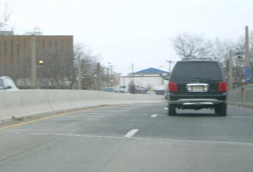 NJ 4 eastbound, crossing the Passaic River into Bergen County. |
||
| 0.17 | Broadway | River Dr, CR 507 {bridge} |
| 0.40 | Broadway | (Orange Ave) [Boulevard] {signal} |
| 0.56 | Broadway | Iozia Terr {signal} |
| 0.64 | Entering (Fair Lawn Boro) [Elmwood Park Boro] | |
| 0.85 | Broadway | (17th St) [E 54th St] {signal} |
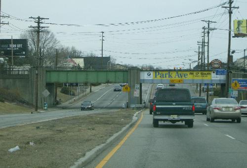 Eastbound, approaching the Erie Railroadís Bergen County Line. |
||
| 0.98 | Broadway | Erie Railroad {underpass} |
| 0.98 | Entering Fair Lawn Boro | |
| 1.10 | Broadway | [Midland Ave, CR 67] {signal} |
| 1.25 | Broadway | Plaza Rd {signal} |
| 1.29 | Broadway | 26th St {signal} |
| 1.48 | Broadway | 30th St {signal} |
| 1.59 | Broadway | (32nd St) [Fair Lawn Pkwy] {signal} |
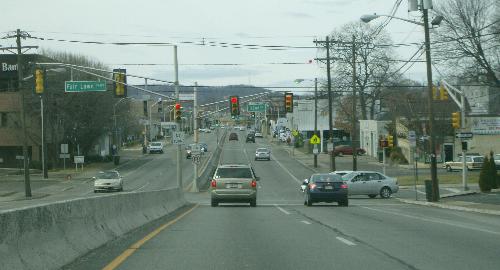 Westbound on Broadway approaching Fair Lawn Parkway. Patersonís Garret Mountain is visible in the distance. | ||
| 1.68 | Broadway | 34th St {signal} |
| 1.82 | Broadway | Yerger Rd {signal} |
| 2.00 | Broadway | (NJ 208) {overpass/merge} |
| 2.11 | Broadway | Saddle River Rd, CR 79 {underpass} |
| 2.28 | Broadway | Saddle River {bridge} |
| 2.28 | Entering Paramus Boro | |
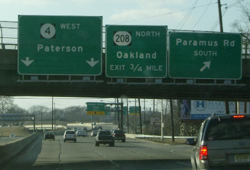 Math problem No. 1: When does 0.38 equal ĺ? When NJDOT erects a sign. The exit for NJ 208 is a mere three-eighths of a mile from this westbound assembly at Paramus Road. |
||
| 2.38 | NJ 4 | Paramus Rd, CR 62 {underpass} |
 A mixed bag of signage, eastbound at Paramus Road. |
||
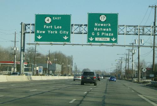 And just an eighth of a mile east, itís much cleaner. |
||
| 2.90 | NJ 4 | Garden State Pkwy, NJ 444 {underpass} |
| 3.05 | NJ 4 | Shopping center connector {underpass} |
| 3.14 | NJ 4 | Sprout Brook {bridge} |
| 3.34 | NJ 4 | NJ 17 {underpass} |
| 3.54 | NJ 4 | Farview Ave, CR 61 {underpass} |
 Help! Too many lanes! This is westbound at Farview Avenue. |
||
| 3.70 | NJ 4 | Herring Brook {culvert} |
| 3.94 | NJ 4 | Spring Valley Rd connector {underpass} |
| 4.02 | NJ 4 | Unnamed stream {culvert} |
| 4.23 | NJ 4 | Pedestrian crossing {underpass} |
| 4.31 | NJ 4 | Forest Ave, CR 59 {underpass} |
| 4.38 | NJ 4 | Pedestrian crossing {underpass} |
| 5.04 | NJ 4 | Van Saun Mill Creek {culvert} |
| 5.04 | Entering River Edge Boro | |
| 5.20 | NJ 4 | Pedestrian crossing {underpass} |
| 5.39 | NJ 4 | Kinderkamack Rd, CR 51 {overpass} |
| 5.42 | NJ 4 | Erie Railroad {overpass} |
| 5.44 | NJ 4 | Coles Brook {culvert} |
| 5.44 | Entering Hackensack City | |
| 5.67 | NJ 4 | Hackensack Ave, CR 503 {underpass} |
| 5.94 | NJ 4 | Hackensack River {bridge} |
| 5.94 | Entering Teaneck Twp | |
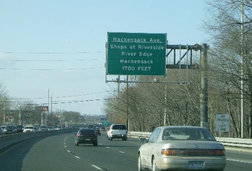 Math problem No. 2, westbound just before the Hackensack River. 1700 feet, you say? How much is that in miles? My calculator says 0.32, but if I use the calculator on my cell phone, Iíll get a ticket (and miss the exit). |
||
| 6.06 | NJ 4 | River Rd connector {bridge} |
| 6.23 | NJ 4 | River Rd, CR 41 {overpass} |
| 6.52 | NJ 4 | Pedestrian crossing {underpass} |
| 6.75 | NJ 4 | Sussex Rd / Garrison Ave {overpass} |
| 6.95 | NJ 4 | Windsor Rd {overpass} |
| 7.00 | NJ 4 | West Shore Railroad {overpass} |
| 7.03 | NJ 4 | Palisade Ave {overpass} |
| 7.14 | NJ 4 | Queen Anne Rd {overpass} |
| 7.35 | NJ 4 | Margaret St {underpass} |
| 7.59 | NJ 4 | Teaneck Rd, CR 39 {underpass} |
| 7.87 | NJ 4 | Pedestrian crossing {underpass} |
| 8.08 | NJ 4 | Webster Ave / Farragut Dr {overpass} |
| 8.25 | NJ 4 | Pedestrian crossing {underpass} |
| 8.52 | NJ 4 | Overpeck Creek {bridge} |
| 8.52 | Entering Englewood City | |
| 8.82 | NJ 4 | Nordhoff Pl {overpass} |
| 8.83 | NJ 4 | Conrail {overpass} |
| 8.87 | NJ 4 | Dean St {overpass} |
| 9.04 | NJ 4 | Grand Ave, NJ 93 / CR 501 {overpass} |
| 9.29 | NJ 4 | Broad Ave {overpass} |
| 9.54 | NJ 4 | Flat Rock Brook {bridge} |
| 9.62 | NJ 4 | Jones Rd {underpass} |
| 9.75 | NJ 4 | Unnamed stream {culvert} |
| 10.03 | Entering Fort Lee Boro | |
| 10.22 | NJ 4 | Bergen-Passaic Expwy, I-95 {overpass} |
| 10.64 | NJ 4 | US 1/9/46 {underpass} |
| 10.81 | NJ 4 | Fletcher Ave, US 9W {underpass} |
| 10.83 | NJ 4 | Bergen-Passaic Expwy, I-95 {merge} |
| 10.83 | END NJ 4, Fort Lee Boro | |