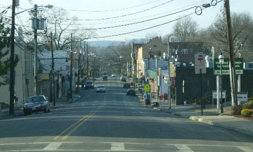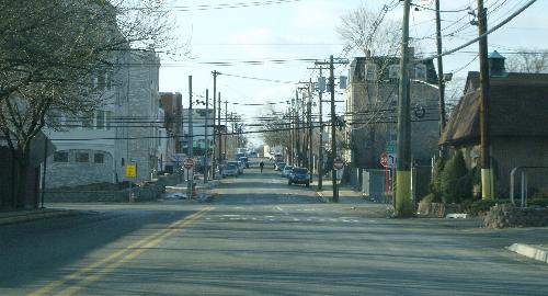
Erie Avenue eastbound just past the county road’s origin at Jackson Avenue.
The road bears an east-west number but actually runs more from north to south. The start of the inventory runs pretty much west to east.
| Mile | Street Name | Feature (North to South) |
| 0.00 | CR 32 BEGINS, Rutherford Boro | |
| 0.00 | Erie Ave | Jackson Ave, CR 507 |
 Erie Avenue eastbound just past the county road’s origin at Jackson Avenue. | ||
| 1.16 | Erie Ave | Union Ave, CR S-32 |
| 1.22 | Erie Ave | Park Ave, CR 30 {traffic circle} |
| 1.27 | Erie Ave | Orient Way - connects with CR 130 1.08 mi south |
| 1.43 | Erie Ave | Hackensack St, CR 55 |
| 1.43 | Erie Ave becomes Meadow Rd | |
| 1.76 | Meadow Rd | Highland Cross / NJ 17 {signal} |
| 1.76 | CR 32 ENDS, Rutherford Boro | |
A narrow steel bridge over the Passaic River that was used from 1896 to 2000 was recently replaced. The current structure opened in 2002. Signage to the road from NJ 21 erroneously labels the road CR 32.
| Mile | Street Name | Feature (West to East) |
| 0.00 | CR S-32 BEGINS, Rutherford Boro | |
| 0.00 | Union Ave | Passaic River {bridge} |
| 0.43 | Union Ave | Jackson Ave, CR 507 {signal} |
 Union Avenue westbound looking toward the Passaic River. | ||
| 1.41 | Union Ave | Erie Ave, CR 32 |
| 1.41 | CR S-32 ENDS, Rutherford Boro | |
| Gap in road due to Erie Railroad | ||
| 0.00 | CR S-32 BEGINS, East Rutherford Boro | |
| 0.00 | Union Ave | Park Ave |
| 0.16 | Union Ave | Hackensack St, CR 55 |
 Union Avenue westbound approaching Hackensack Street. | ||
| 0.32 | Union Ave | NJ 17 {signal} |
| 0.32 | CR S-32 ENDS, East Rutherford Boro | |